
“It's a mess, ain’t it Sheriff?
If it ain’t it'll do till a mess gets here.” ― Cormac McCarthy, “No Country for Old Men”
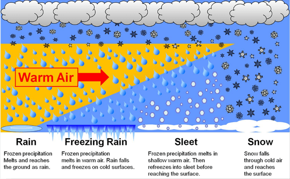
One of the messiest storms of the season is about to plow into Minnesota. Our inbound weather system brings a rainy, icy, sleety, snowy mix to different parts of Minnesota Wednesday night through Thursday.

Winter storm warnings are posted for areas in and around the Twin Cities and along the North Shore. Winter weather advisories cover most of the rest of Minnesota.
Here’s the language in the Twin Cities area winter storm warning.
Including the cities of St Peter, Chanhassen, Hutchinson, Victoria, Gaylord, Chaska, St Paul, Redwood Falls, Shakopee, Hastings, Red Wing, Le Sueur, Stillwater, New Ulm, Faribault, Minneapolis, and Olivia
220 PM CDT Wed Apr 1 2026 …WINTER STORM WARNING REMAINS IN EFFECT FROM MIDNIGHT TONIGHT TO NOON CDT THURSDAY…
* WHAT…Heavy mixed precipitation expected. Total snow accumulations up to one inch, sleet accumulations around three quarters of an inch, and ice accumulations around one quarter of an inch. Winds gusting as high as 30 mph.
* WHERE…McLeod, Renville, Sibley, Carver, Dakota, Hennepin, Ramsey, Scott, Washington, Brown, Le Sueur, Nicollet, Rice, Goodhue, and Redwood Counties.
* WHEN…From midnight tonight to noon CDT Thursday. * IMPACTS…Roads, and especially bridges and overpasses, will likely become slick and hazardous. Significant ice accumulation on power lines and tree limbs may cause widespread and long-lasting power outages. Plan on slippery road conditions. The hazardous conditions will impact the Thursday morning commute.
Let’s break down storm timing, coverage, and precipitation types. Then look ahead to the second system rolling in Friday and Saturday.
System No. 1 Wednesday night and Thursday
Our first weather maker is a Colorado low tracking through Iowa Thursday. I’m a little leery of track and precipitation type forecast accuracy with these systems lately as they pass right through the zone with fewer weather balloon launches from Colorado through Nebraska and South Dakota.
Most forecast models have similar solutions featuring mainly snow in the northern half of Minnesota with a rainy icy mix south.
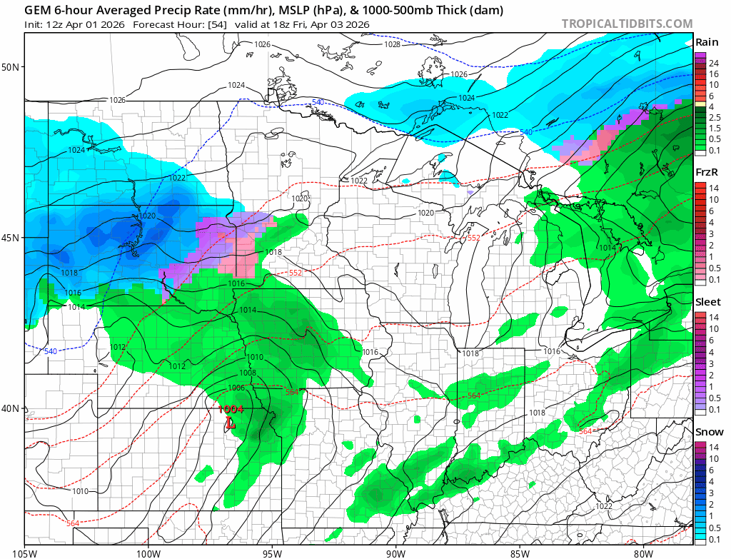
The National Oceanic and Atmospheric Administration’s NAM 3 km model shows the rain, ice and snow zones increasing in coverage overnight into Thursday. The forecast model loop below runs between 7 p.m. Wednesday and 1 a.m. Friday.
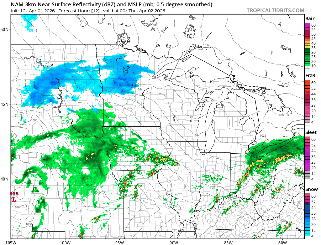
Southern Minnesota
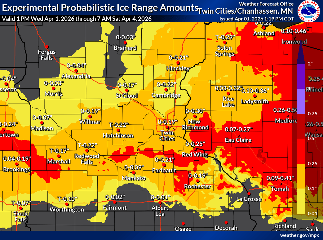
Southern Minnesota will see a mix from rain south to icy precipitation around the Twin Cities area. The ice and sleet could get heavy overnight into early Thursday.
Some areas could see up to an inch of sleet accumulation, and it could be pinging off your windshield during your Thursday morning commute.
Glaze ice is also likely from the Twin Cities east into central Wisconsin where ice storm warnings are up.
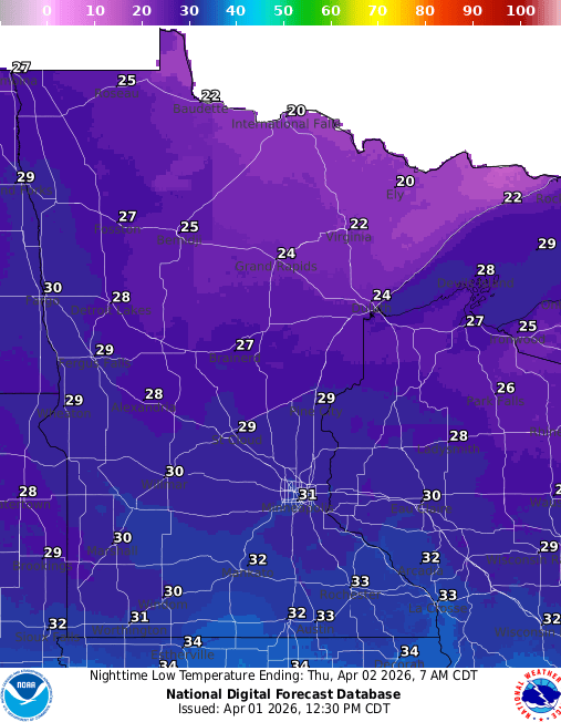
Thursday’s morning commute looks like the most impactful time. With temperatures right around 32 degrees a variety of precipitation types may fall.
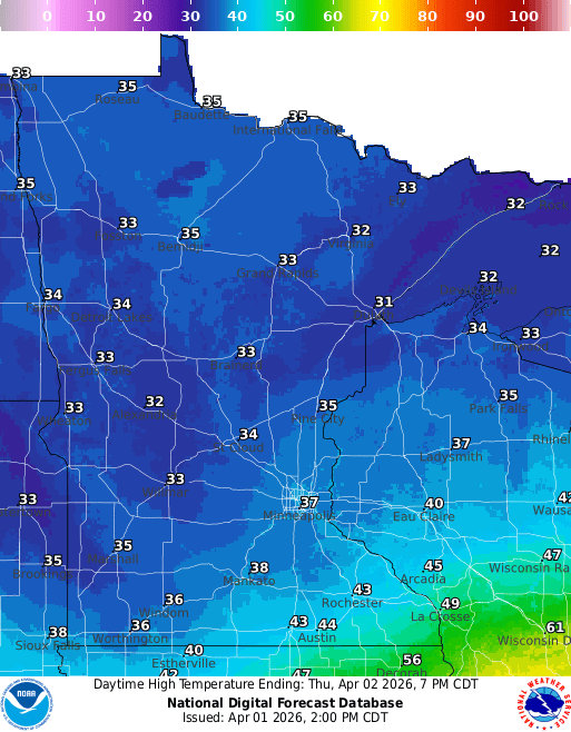
It should be warm enough for mostly rain by Thursday afternoon from the Twin Cities south.
Central and northern Minnesota
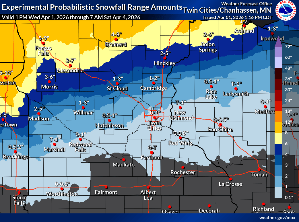
To the north, it will be mostly wet, heavy sloppy snow. The heaviest snow zone favors the North Shore where 5 to more than 10 inches is likely. (See the map at the top of the post.) There will be less snow as you move farther south.
System No. 2 Friday and Saturday
The second system appears to track slightly farther north. That could mean more rain for the Twin Cities with another shot of heavy wet snow north.
The Canadian model seem reasonable as a solution at this point. The forecast model loop below runs between 1 p.m. Friday and 1 a.m. Sunday.
Overall snowfall again favors northern Minnesota.
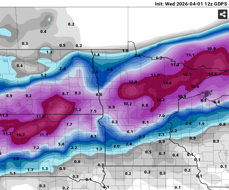
On the map below, this Canadian model (Kuchera) snowfall output for both systems runs through 7 a.m. Sunday. I think the potential for more than a foot of heavy wet snow is possible across the north and especially the North Shore regions by Sunday.
Easter Sunday looks sunnier and cool.
There are signs we may warm up into the 50s and 60s south again by next Wednesday.
Take it easy out there, Minnesota.